Kharagpur
Kharagpur
Kharagpur (KGP) is an industrial town in India. It is located in the Midnapore West district of the state of West Bengal. Features as BNR or Bengal Nagpur Railway), Midnapore (going north) and Balasore of Orissa state (heading southwards along the coast of the Bay of Bengal).
Kharagpur was chosen as the location of the first campus of the prestigious Indian Institutes of Technology (IITs). The IITs are the premier technical education institutes in India and are internationally recognised for their academic and technical excellence. Unlike other IITs, IIT Kharagpur has been long known for its ability to offer unusual courses not offered in other IITs. It also has a reputation for student bonding, unique hostel life and extensive extracurricular activities. The campus is located in Hijli.
Kharagpur also has one of the biggest railway workshops in India with the longest railway platform in the world.
 |
| IIT Kharagpur |
Kharagpur lies on the latitude of 22 02' 30” & longitude 87 11' 0”, covering an area of about 3000 km² located in the south-west part of Midnapore. This sub-division town is formed with Dalma Pahar and alluvial tract of Midnapore. It is intersected by numerous waterways, the important rivers being Subarnarekha, Keleghai and Kangsabati River.
Kharagpur is located at . It has an average elevation of 29 metres (95 ft).
History :- Historically, Kharagpur was a part of Hijli Kingdom and ruled by Bengali Hindu rulers. Historians claim that as early as the 16th century, Kharagpur was still a small village surrounded by dense forests. The village was on high rocky barren land. The only inhabited settlement near Kharagpur was Hijli. Hijli was a small island village on the banks of River Rasulpur in the delta of Bay of Bengal. It developed into a Port town in 1687. Hijli was also a Province and was in existence till 1886. It covered parts of Bengal and Orissa. It had important towns like Tamluk, Panskura, Debra along with Kelghai & Haldi rivers on the North, the South and East sides bounded by Bay of Bengal and Kharagpur, Keshiary, Dantan and Jaleswar on the West.
Hijli was ruled by Taj Khan who was the disciple of Guru Peer Mackdram Sha Chisti. It was also ruled by Kushan, Gupta and Pal dynasties and also by the Mughals. It is said that Hijli had excellent business and trade centers with Judiciary, Jail and Administrative offices during the reign of Hindu Kings and during the Moghul Raj. It was at its peak in 1754 AD and the prosperity of Hijli Province during this period was beyond description. The capital of Hijli was in Bahiri up to 1628 A.D. and was shifted to Hijli afterwards.
In the 18th century another Port town Khejuri came into existence, primarily set up by the British for carrying out trade with European countries. Khejuri was also an island set up on the banks of River Koukhali in the delta region. Development of this region because of Khejuri and Hiji Port can be gauged by the fact that the first Indian Telegraph Office was established in 1852 connecting Khejuri with Calcutta. In the devastating cyclone of 1864, both the ports got destroyed. The islands have since got merged with the mainland.
 |
| Hijli Detention Camp |
Captain Nicolson was the first English colonialist to invade Hijli and captured the Port only. In 1687 Job Charnock with 400 soldiers and warships captured Hijli defeating Hindu & Mughul defenders. After the war with the Mughals, a treaty was signed between Job Charnock and the Mughul Emperor. The loss suffered by Job Charnock forced him to leave Hijli and proceed towards Uluberia while the Mughul Emperor continued to rule the Province. From there they finally settled at Sutanuti in Kolkata for establishing their business in Eastern India. This was the start of East India Company in India. Hijli as we know it today, is only a very small part of erstwhile Hijli Province and was created for establishing administrative offices by the British in the 19th century. It is curious that almost the entire Kharagpur division of today has boundaries identical to Hijli Province.
It is said that the name of Kharagpur derived from the name of old Shiva temple called ‘Khargeswar' located at the outskirts of Kharagpur. It is also said that the Temple was established by King Kharag Singh Pal and was named after him. The place of Kharagpur has mythological importance too. As depicted in Mahabharata, this area was ruled by the Demon King Hiramba. Pancha Pandavas spent a part of their repatriation years here. Bhim had fallen in love with Hirimba, sister of Hiramba. This annoyed Hiramba who clashed with Bhim. Hiramba was killed by Bhim at the same place where Khargeswar Temple is located.
 |
| Khargeswar Temple |
Railways:-- The first Railway establishment at Kharagpur started with the commissioning of the rail link between Cuttack – Balasore – Kharagpur and from Sini to Kolaghat via Kharagpur. Kharagpur as a junction station was established in Railway map in December 1898. The public mood and the reaction of society on introduction of rail transport in this region has been nicely depicted by the famous Bengali Novelist Dr Ramapada Choudhury who was born and brought up in Kharagpur, in his Bengali novel Prothom Prohor. It is said that the people were initially afraid to travel by train for the fear of accident over the bridge (fear of collapsing of bridge), fear of getting outcaste status since there were no separate seating arrangement for different castes and religions. However, things changed due to famines in the early 20th century. The Railway Company came forward and offered jobs to the local unemployed men, gave them free ride by train and even offered a blanket for traveling by train. This promotional scheme broke the taboos and made rail transport acceptable to the society.
Midnapur, the District Headquarters was connected (up to the bank of Kosai river) in February 1900. Construction of the bridge over Kosai completed in June 1901. The rail line from Howrah to Kolaghat up to the Eastern bank and from Kharagpur up to Western bank of Rupnarayan River was completed in 1899. However through trains between Howrah and Kharagpur could only be possible in April 1900 after the bridge over Rupnarayan river was completed.
Howrah – Amta light Railway (2 ft gauge - 610mm ) line was completed in 1898 and was operated by M/s Martin & Co. of Calcutta. This link remained operative till 1971. After closure of the light Railways, demand for a broad gauge line between Howrah and Amta gained momentum. The project got completed in four phases. In the first phase, the line between Santragachi and Domjur was completed in 1984. In the 2nd phase under Project Unigauge it got extended up to Bargachia in 1985. Extension up to Mushirhat (Mahendralal Nagar station) was completed in 2000 and the final lap up to Amta got completed in December 2004.
The need for rail link between Panskura and Tamluk was conceived at the beginning of 20th century, almost at the same time when the rail link between Howrah and Kharagpur was opened. Railway company received offers for construction from two Agencies, M/S Martin & Company and M/s Babu Nibaran Chandra Dutta. The former against guaranteed return of 3.5% while the latter without any guarantee. Although the offer of the latter was lucrative, the dilemma of whether to offer the work of construction to a native or not forced the project to be abandoned. After Independence, the requirement of rail link connecting Panskura and Durgachak came up primarily for the purpose of constructing Haldia Port. The rail link between Panskura – Durgachak via Tamluk completed in 1968, which was later on extended to Haldia in 1975. Extension of rail link to Digha from Tamluk was sanctioned in 1984 and it took 20 years to complete this project in two phases, the first phase of linking Tamluk and Contai completed in November 2003 and the tourist destination Digha got connected to Howrah/Shalimar in December 2004.
 |
| Kharagpur Station |

Kharagpur jn main gate
Geography:--Kharagpur is the fourth largest city of West Bengal in area after Kolkata, Durgapur and Asansol. It is also the fifth most populated city of West Bengal after Kolkata, Asansol, Siliguri, Durgapur - located at 22.330239°N 87.323653°E, covering an area of about 127 km2 in southern part of West Midnapore.[13] It has an average elevation of 29 metres (95 ft). This sub-division town is formed with Dalma Pahar and alluvial tract of Midnapore. It is intersected by numerous waterways, the important rivers being Subarnarekha, Keleghai and Kangsabati.
Geographical location of Kharagpur and its rail links with the rest of the Country favoured construction of a centralized Workshop with facilities to carry out major repairs of all broad gauge stock. In 1900 the work was sanctioned and the construction of the Workshop completed in 1904.
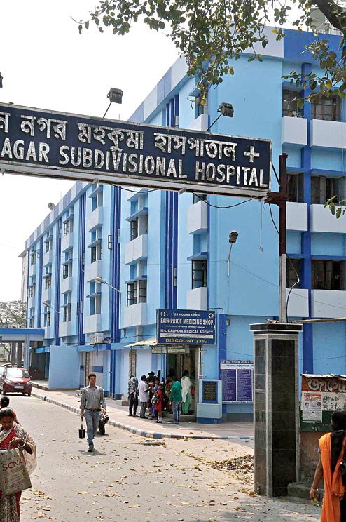 |
| Kharagpur Hospital |
Hospital :- The need for a centralized Hospital at Khargpur was also felt in late 19th century and the Hospital with complete medical facilities was established in 1897. Dr Arthur Martin Leake, Victorian Cross winner was appointed as Chief Medical Officer of Kharagpur Hospital in 1904.
On 16th September 1931, freedom fighters in Hijli Jail celebrated the killing of Sessions Judge Mr Garley, who had passed death penalty to famous Freedom fighter Shri Dinesh Gupta. The Jail authorities could not tolerate this and killed the freedom fighters in their cell. Today the infamous Hijli Jail is located inside the IIT campus area. Now the name of Kharagpur is synonymous with IIT. The railway establishment bears testimony of its (IIT Kharagpur's) development in the initial years. The Father of Nation Mahatma Gandhi served his term in the Hijli Jail as did Khudiram Bose, an eminent Freedom fighter of Bengal.
Education
Colleges
- Indian Institute of Technology Kharagpur
- Kharagpur College (also known as Inda College)
- Hijli College
- Kharagpur Homoeopathic Medical College and Hospital
- Dr B C Roy Institute of Medical Science & Research
 |
| IIT Kharagpur |
 |
| Kharagpur College |
 |
| Hijli College Main Gate |
| Hijli College |
 |
| Kharagpur Homoeopathic Medical College |
 |
| Dr B C Roy Institute of Medical Science |
Industrial setup


Kharagpur has one of the largest industrial setups in West Bengal. Several large industrial plants are located in and around Kharagpur due to its proximity to Kolkata, good rail and road connectivity via NH 6 and NH 60, availability of labour, and raw materials. Important establishments like Tata Metaliks, Tata Bearings, Siemens, Kharagpur Metal, ISD Cement, Godrej, Tata Hitachi, Century Extrusions, Humboldt Wedag, Rashmi Metaliks, BRG Group, Bengal Energy, Ramco Cements have set up their plants in and around Kharagpur. Many small iron rolling mills and rice mills dot the town. The Vidyasagar Industrial Park is located here.[28] Establishment of an IT park is also in progress.[29][30][31] Kharagpur will be part of two new economic corridors EC-1 Mumbai-Kolkata and EC-14 Kharagpur-Siliguri under Bharatmala project.[32][33] There is also a flourishing real estate market. Recently, the government has revealed plans to establish a civilian airport.
Kharagpur is a place where people from every religion and castes from all over the country reside. Kharagpur still retains its small-town charm and literally shuts down at 10 o'clock every night but for the IIT Kharagpur zone. However night life in Kharagpur and its suburbs are gradually developing with the mushrooming of various night clubs and hotels. The major industries present in Kharagpur are:
Existing Industrial Units:
- Aso Cement Ltd. (Slag Cement)
- Flender MacNeill (Industrial Gears)
- Humboldt Wedag (I) Ltd. (Slurry Pumps)
- SE Railway Workshop (Carriage, Wagon, Steal and Diesel Locomotive Maintenance)
- Tata Bearings Ltd. (Bearings and its Castings)
- Tata Davy Ltd. (Heavy Engineering)
- Tata Metaliks Ltd. (Pig Iron Plant)
- Wellman Wacoma Ltd. (Coke Oven/Metallurgical Coke)
- Rashmi Metaliks (PIG Iron Manufacturing Unit)
Upcoming Major Units:
- Aso Cement Ltd. (Cement (expansion))
- Century Iron & Steel
- Industries Ltd. (Pig & Sponge Iron)
This area promises to be an ideal destination for investment due to the presence of the IIT campus, its proximity to Kolkata and also because it is well-connected with the rest of the nation by rail. There are marketplaces called Gole bazar, Puratan Bazar and Gate Bazar, a super market at co-operative Golebazar and one at Malancha. Kharagpur has one more station on it "Giri Maidan". There is a place called Mathurakati which is purely railway colony which contains railway quarter for the rich railway employees.
Movie theaters include Bombay Cinema, Aurora Cinema, South Institute and Miloni Cinema. Places of worship include a Masjid near Gole Bazar,a Gurudwara at Subhaspally and several temples and churches. The South Side of Kharagpur is a planned area belonging to the Indian Railways which was established by Britishers as residential area. Nearby is The Kharagpur Municipality and the fire station. It also contains famous telugu schools like Andhra High School and Vidya Peetham.The most famous festivals here are Durga puja and Ammavaari puja celebrated at places like Jaihing Nagar.
Labels: India, Kharagpur, Midnapore, Paschim Medinipur, West Bengal
posted by Manish Kumar @ July 14, 2020
2 Comments
![]()

2 Comments:
how many distance between kharagpur to iit kharagpur
3 km approx
Post a Comment
Subscribe to Post Comments [Atom]
<< Home